Ideas for trail running routes | Aime - La Lance via Valezan

An idea for a beautiful trail running route!
Discover the trails on the Versant du Soleil.


All year round daily.
Subject to snow conditions.
Subject to snow conditions.
***The trail is not marked. You can choose different paths. Please note that you may find yourself on shared sections of routes.***
--------------
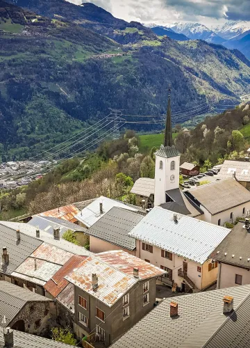
This is a 17km hiking / running trail with 880m elevation gain through vineyards and the villages of Montméry, Valezan, La Lance, La Bergerie and La Côte d'Aime. It is an ideal all-round route with rolling sections, climbs and descents.
Anyone who wants to get started again more gently can opt for the variant of only going up to Montméry, for a distance of 11km and 480m elevation gain.
Another idea for a lovely outing is to start from Le Villard de La Côte d'Aime, for a distance of 8km and 350m elevation gain.
So, if this tempts you to get your running shoes on, the GPX routes are at the bottom of the page.
Please note that the route includes sections of road. Roads are a shared collective space where all users - motorists, bikers, cyclists and pedestrians - are obliged to respect the Highway Code.
As pedestrians, you are particularly vulnerable, so be extra vigilant.
--------------
This is a 17km hiking / running trail with 880m elevation gain through vineyards and the villages of Montméry, Valezan, La Lance, La Bergerie and La Côte d'Aime. It is an ideal all-round route with rolling sections, climbs and descents.
Anyone who wants to get started again more gently can opt for the variant of only going up to Montméry, for a distance of 11km and 480m elevation gain.
Another idea for a lovely outing is to start from Le Villard de La Côte d'Aime, for a distance of 8km and 350m elevation gain.
So, if this tempts you to get your running shoes on, the GPX routes are at the bottom of the page.
Please note that the route includes sections of road. Roads are a shared collective space where all users - motorists, bikers, cyclists and pedestrians - are obliged to respect the Highway Code.
As pedestrians, you are particularly vulnerable, so be extra vigilant.
Difficulty Level
Level black - very hard
Characteristic
Animals accepted
yes
Duration
2h00
Distance
17 km
Elevation gain
860 m
Descent
860 m
Type of itinerary
Circuit
Prices
Free access.
Languages spoken
French
Location
Au départ de l'Eglise Aime
73210 Aime-la-Plagne
How to get there
73210 Aime-la-Plagne
700m
La Plagne Vallée
Contacter l’office de tourisme :