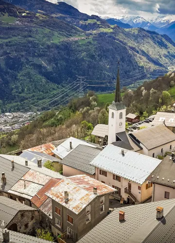
Hiking route : Tour de la Roche de Janatan trail

Discover a superb viewpoint of the Beaufortain and Vanoise massifs from the top of Roche de Janatan.

From 01/01 to 31/12 daily.
Subject to snow cover.
Subject to snow cover.
At the Chapieu parking lot, look for a small trail along the water’s edge and a large rock that serves as a landmark.
1/ Take the trail toward La Combe, then cross the Tessens stream via the small bridge.
2/ At the “Quatre Chemins” sign, continue straight ahead toward La Roche de Janatan (1 hr 30 min).
3/ Follow the cairns and the signs for “La Bagnaz.” Hike up the slope, keeping well to the right.
4/ The Roche de Janatan cross will appear on your right (you can reach it via a small trail through the rocks).
5/ Continue along the ridge leading to the “Pointe du Col,” then head to the Col de la Légette.
6/ At the Col de la Légette, cross the alpine pasture to reach the path visible on your right (marked by a chalet and a road open to vehicles).
7/ Descend via the Chalet des Mouilles, the “Boulissoir,” and the hamlet of La Pesée, then return to Le Chapieu.
1/ Take the trail toward La Combe, then cross the Tessens stream via the small bridge.
2/ At the “Quatre Chemins” sign, continue straight ahead toward La Roche de Janatan (1 hr 30 min).
3/ Follow the cairns and the signs for “La Bagnaz.” Hike up the slope, keeping well to the right.
4/ The Roche de Janatan cross will appear on your right (you can reach it via a small trail through the rocks).
5/ Continue along the ridge leading to the “Pointe du Col,” then head to the Col de la Légette.
6/ At the Col de la Légette, cross the alpine pasture to reach the path visible on your right (marked by a chalet and a road open to vehicles).
7/ Descend via the Chalet des Mouilles, the “Boulissoir,” and the hamlet of La Pesée, then return to Le Chapieu.
Difficulty Level
Level red – hard
Characteristic
Animals accepted
yes
Duration
4h00
Distance
9.43 km
Elevation gain
700 m
Descent
700 m
Type of itinerary
Circuit
Prices
Free access.
Nature of the terrain
Not suitable for strollers
Stone
Hard coating (tar, cement, flooring)
Ground
Accuracy of Markings
Signage may be missing or difficult to see in some places. Follow the route description and the map provided.
Downloadable files
GPX Track - Hiking Route: The Roche de Janatan Trail_Aime-la-Plagne
Download
Location
Parking du Chapieu Tessens Aime
73210 Aime-la-Plagne
How to get there
73210 Aime-la-Plagne
700m
La Plagne Vallée
Contact the tourist office: