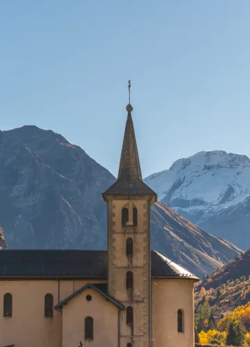
Walking itinerary : Alpage de Froide Fontaine

Walk up on this beautiful path located in Champagny-le-Haut taking you on the southern side of the small valley, in the grassy slopes up to the alpine chalet of Lécheron. Amazing view guaranteed!


From 01/05 to 01/11 daily.
Subject to favorable snow and weather conditions.
Subject to favorable snow and weather conditions.
Starting point: Champagny Le Haut, car park in the hamlet Le Bois
Arrival: idem
Duration: 2:45 hrs (1:45 uphill)
Life in the mountain pastures of Lécheron: at this altitude, without electricity or mechanical means, life in this mountain pasture takes place over a period of 4 months in very difficult conditions; it is punctuated by the care of the animals, milking and the production of cheese (tommes). Direct sales are possible.
Then trail from Lécheron to Passage de la Frête.
Arrival: idem
Duration: 2:45 hrs (1:45 uphill)
Life in the mountain pastures of Lécheron: at this altitude, without electricity or mechanical means, life in this mountain pasture takes place over a period of 4 months in very difficult conditions; it is punctuated by the care of the animals, milking and the production of cheese (tommes). Direct sales are possible.
Then trail from Lécheron to Passage de la Frête.
0/ From the car park in the hamlet of Le Bois (near the refuge), take the road in the direction of the hamlet and along the church (signposted "Lécheron/Boucle de l'Adret/Les Teppes"). At the crossroads (admire the façade of the "Plancher des vaches"!), turn right towards the meadows. Instead of taking the "Promenade confort" path, turn left towards Lécheron.
1/ The path starts and rises above the village. First, the path zigzags through the forest and then, above it, moves between boulders on grassy slopes leading to the Lécheron alpine chalet (alt. 2094 m). From the end of June to the beginning of September, a farmer lives here with her herd of goats and a few cows.....
2/ Continue the climb above Lécheron to reach the "Froide Fontaine" mountain pasture and eventually the ridge called "Passage de Frête" (alt. 2522 m). Count on 1h10 of ascent. Additional difference in altitude: +430 m.
Descent: by the same route.
1/ The path starts and rises above the village. First, the path zigzags through the forest and then, above it, moves between boulders on grassy slopes leading to the Lécheron alpine chalet (alt. 2094 m). From the end of June to the beginning of September, a farmer lives here with her herd of goats and a few cows.....
2/ Continue the climb above Lécheron to reach the "Froide Fontaine" mountain pasture and eventually the ridge called "Passage de Frête" (alt. 2522 m). Count on 1h10 of ascent. Additional difference in altitude: +430 m.
Descent: by the same route.
Difficulty Level
Level red – hard
Characteristic
Minimum age
7 yrs
Duration
2h45
Distance
8.01 km
Elevation gain
985 m
Descent
985 m
Type of itinerary
Return
Prices
Free access.
Nature of the terrain
Not suitable for strollers
Stone
Ground
Accuracy of Markings
Tricky Passages
Tourisme adapté aux handicaps
Not accessible in a wheelchair
Location
Route du Col du Palet Parking du Bois Hameau Le Bois Champagny le Haut
73350 Champagny-en-Vanoise
How to get there
73350 Champagny-en-Vanoise
1250m
Champagny-en-Vanoise
Contacter l’office de tourisme :