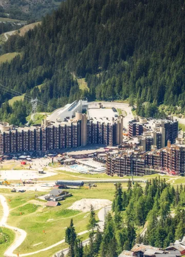
TRAIL Route - 6D Lakes

Difficulty: Very challenging
Departure from Plagne Bellecôte
Slip into the running shoes of a competitor in one of the legendary 6000D events.
Route Trail: The 6D Laks - Difficulty: Very challenging
Distance: 27.7 Km
1600 m uphill/1600 m downhill
Departure from Plagne Bellecôte
3,2,1, go! Slip into the running shoes of a competitor in one of the legendary 6000D events. Warning: the trail is not signposted on the ground.
The route starts at Plagne Bellecôte (accessible by free shuttle) and climbs up to the Dou du Praz plateau along a public footpath as far as la Fruitière.
It then continues on a paved road to Lac des Blanchets. From there, it takes a little path overlooking the lake and joins a tarmacked road to the top of the Roche de Mio and the Col de la Chiaupe. From the pass, you descend via the Dérochoir to Plan Bois and from there one last climb takes you to the summit of the Arpette.
You finally descend to Belle Plagne and Plagne Bellecote along trails through alpine meadows.
Distance: 27.7 Km
1600 m uphill/1600 m downhill
Departure from Plagne Bellecôte
3,2,1, go! Slip into the running shoes of a competitor in one of the legendary 6000D events. Warning: the trail is not signposted on the ground.
The route starts at Plagne Bellecôte (accessible by free shuttle) and climbs up to the Dou du Praz plateau along a public footpath as far as la Fruitière.
It then continues on a paved road to Lac des Blanchets. From there, it takes a little path overlooking the lake and joins a tarmacked road to the top of the Roche de Mio and the Col de la Chiaupe. From the pass, you descend via the Dérochoir to Plan Bois and from there one last climb takes you to the summit of the Arpette.
You finally descend to Belle Plagne and Plagne Bellecote along trails through alpine meadows.
Difficulty Level
Level black - very hard
Characteristic
Animals accepted
yes
Distance
27.7 km
Elevation gain
1600 m
Descent
1600 m
Type of itinerary
Circuit
Prices
Free access.
Nature of the terrain
Stone
Rock
Ground
Languages spoken
French
Downloadable files
Itinéraire 6D Lacs
Download
Location
Départ Plagne Bellecôte
73210 La Plagne
How to get there
73210 La Plagne
1930m
Plagne Bellecôte
Contacter l’office de tourisme :